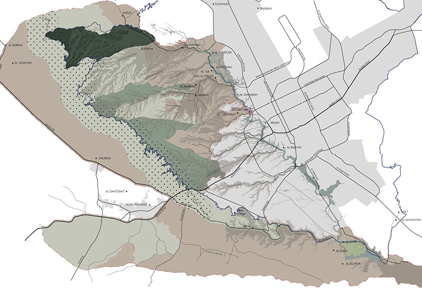
INDEXA in partnership with Barton Willmore has been commissioned by Arriyadh Development Authority (ADA) to produce a concept and management plan for Al-Aridh national park, 3500 km2 to the west of Riyadh. The study area contains a vast range of landscape and various environments, topographies, soil, plant types, and more. Our role in this project was to set up urban policies to this highly sensitive environmental area. In this project, INDEXA has used GIS tools first to put together all the different and complicated data and information of the land and connect them spatially to better visualize the huge area and make the right decisions with the help of the different GIS analytical tools. Indexa then used GIS’s abilities to classify the land and create different zones where each zone has been assigned with the appropriate development policies.
Recent Comments